


| NAME | MAP COORDINATES (see maps below) TL=top left TR=top right BL=bottom left BR=bottom right |
LOOCATION & COMMENTS
|
|---|---|---|
| Bejou Cemetery | TL 1300/1400 | North of Bejou on the west side of 59. |
| Duane Cemetery | TR 2100/2200 | Beaulieu, MN, North of Hwy 200 on county road 3. |
| Duane Baptist Cemetery | TR 1600/2400 | SE of county roads 1 and 3 and about a quarter mile east of the road along a farm field. It was a Baptist Church Cemetery, but no church currently exists. |
| First Lutheran Cemetery | BL 2300/1350 | Mahnomen, MN, West side of town on county road 10. |
| Free Gospel Alliance Cemetery | BR 2600/3050 | Naytahwaush, MN. |
| Pine Bend Cemetery, aka Pine Bend Mission Cemetery, Information contributed by Cindy Thorpe | TR 1450/3200 | SE of Lengby |
| Pine Bend Mission Cemetery, aka Pine Bend Cemetery, Information contributed by Sandy Dennis | TR 1450/3200 | White Earth Indian Reservation at Pine Bend |
| Riverside Cemetery | BL 2400/1300 | Mahnomen, MN, SW of town on county road 10. |
| Saint Agnes's Cemetery (Catholic) | TR 1300/3000 | Near Island Lake, Lengby, MN, on the West side of county road 4 South of Lengby. |
| Saint Anne's Cemetery (Catholic) | BR 2600/3050 | Naytahwaush, MN |
| St Annes' Cemetery | BL 3200/1600 | Waubun, MN, on the West side of 59 just North of Hwy 113. |
| Saint Joseph's Cemetery (Catholic) | BR 2300/2200 | Affiliated with St. Joseph's Church of Beaulieu. Beaulieu, MN. It is South of Hwy 200 on county road 3 situated on the North side of Church Lake. |
| Saint Michael's Cemetery | BL 2400/1400 | Mahnomen,MN, South of town on county road 5 |
| Samuel Memorial Cemetery (Episcopal) | BR 2600/3000 | Naytahwaush, MN |
| Waubun Cemetery | BL 3300/1600 | Also known as Mahnomen cemetery and located on the west side of Highway 59, 1/2 mile south of Hwy 113. It is 1/2 mile north of the Becker/Mahnomen County line. It was originally thought to be in Becker County, but now it has been clarified as being in Mahnomen County. |
| Wicksburg or Wickburg Cemetery | TR 1400/2400 | NE of county roads 1 and 3. It is adjacent to the Hier Town Hall building. The cemetery actually has a sign that says "Duane Cemetery," but that is incorrect. |
| - | BL 2350/1550 | Mahnomen, MN, SE of town, East side of Hwy 59. |
| - | TL 2200/1700 | Mahnomen, MN, West of Mahnomen on Hwy 200 and county road 135 next to a village hall building. |
| - | BR 3300/2100 | Hwy 113 and county roads 13 & 113 |
| Note: Lengby is not in Mahnomen County and is just off the map at 1000/3000... it is located just south of Hwy 2 in Polk county, but is probably the best reference point for locating Pine Bend and St. Agnes's Cemeteries. | ||
| NEAR MAHNOMEN COUNTY | ||
| Anderson Cemetery | - | Elbow lake at the Mahnomen, Becker & Clearwater county borders |
| Ebro Cemetery | - | On the reservation just east of the Mahnomen County Line. |
| Perch Lake Cemetery | - | This Rice Lake cemetery may lie in Clearwater County rather than Mahnomen |
| Walworth Cemetery | - | Walworth Baptist Church and its cemetery are located on the SW corner of the county. It may actually be located in Becker or Norman County. |
TOP LEFT QUARTER (TL)
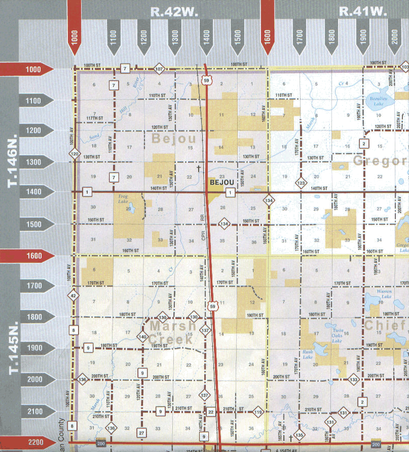
TOP RIGHT QUARTER (TR)
 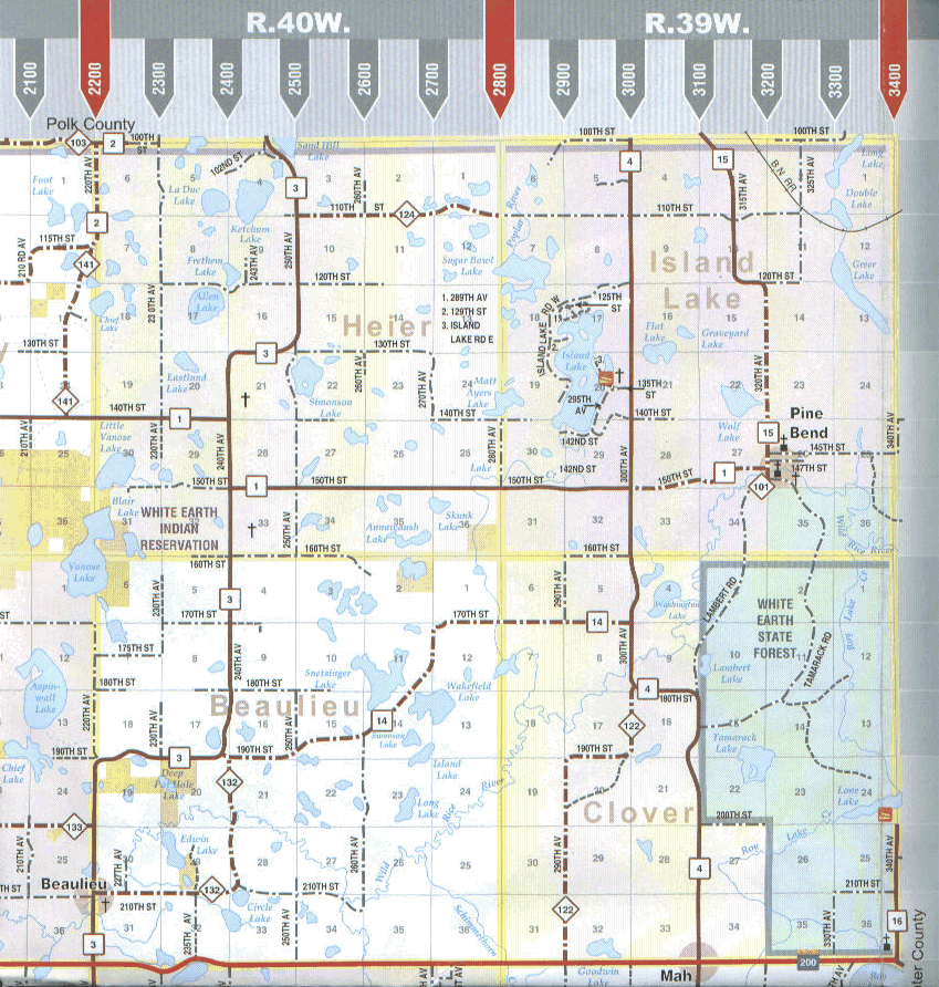 |
BOTTOM LEFT QUARTER (BL)
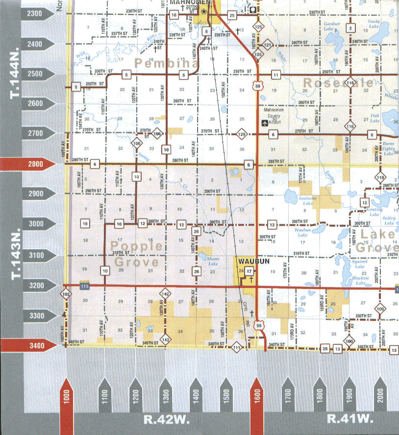
BOTTOM RIGHT QUARTER (BR)
 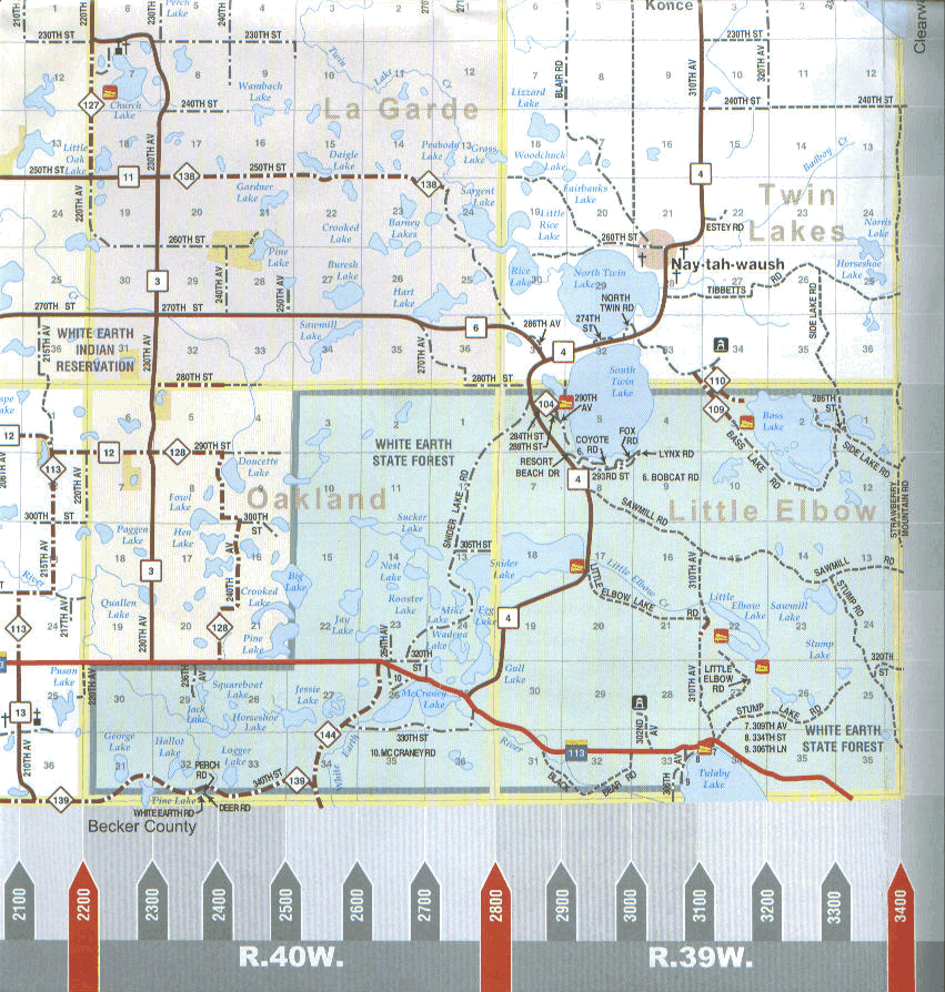 |
|
Mahnomen Co., MNGenWeb Project
Thanks to Rootsweb for hosting this site |
|||
|
|||
|
©Copyright ~ Barbara Koska Timm
|
